Difference between revisions of "Springfield Road Network"
Steve Cable (Talk | contribs) |
|||
| (5 intermediate revisions by the same user not shown) | |||
| Line 1: | Line 1: | ||
[[File:springfield_ovw_maponly.jpg|thumb|400px]] | [[File:springfield_ovw_maponly.jpg|thumb|400px]] | ||
| − | + | The '''Springfield 2022 custom road network''' consists of a large interstate highway loop, rural roads, and urban and residential areas. The Driving Safety Research Institute will supply this road network with sample scenarios and external reference scenarios that which set the traffic, signs, and signals. Ambient oncoming traffic is provided via the ISAT traffic manager function. More complex custom scenarios can be delivered to meet customer specifications at additional cost. | |
| − | The Springfield | + | |
<html> | <html> | ||
<ul> | <ul> | ||
| − | <li>Built, | + | <li>Default settings included for signs and signals</li> |
| − | <li>Ambient | + | <li>Built, tested, and ready to go!</li> |
| + | <li>Ambient traffic</li> | ||
| − | <li>Large, | + | <li>Large, diverse environment |
<ul> | <ul> | ||
<li>285 square miles</li> | <li>285 square miles</li> | ||
| Line 20: | Line 20: | ||
<li>Supports many applications | <li>Supports many applications | ||
<ul> | <ul> | ||
| − | <li>Automation | + | <li>Automation development</li> |
| − | <li> | + | <li>User-interface testing</li> |
| − | <li> | + | <li>Impairment research</li> |
| − | <li>Outreach | + | <li>Outreach and education</li> |
</ul> | </ul> | ||
</li> | </li> | ||
Latest revision as of 10:27, 14 February 2023
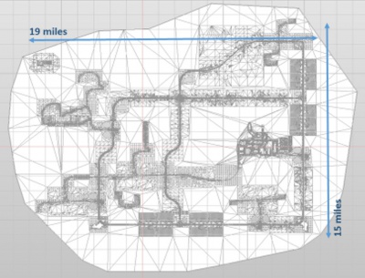
The Springfield 2022 custom road network consists of a large interstate highway loop, rural roads, and urban and residential areas. The Driving Safety Research Institute will supply this road network with sample scenarios and external reference scenarios that which set the traffic, signs, and signals. Ambient oncoming traffic is provided via the ISAT traffic manager function. More complex custom scenarios can be delivered to meet customer specifications at additional cost.
- Default settings included for signs and signals
- Built, tested, and ready to go!
- Ambient traffic
- Large, diverse environment
- 285 square miles
- 230 miles of roadway
- 178 intersections
- 143 traffic signals
- 1362 signs
- Supports many applications
- Automation development
- User-interface testing
- Impairment research
- Outreach and education
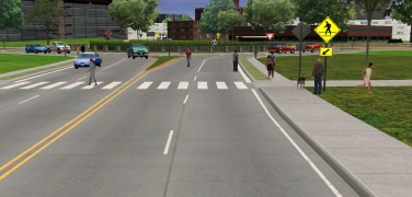
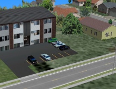
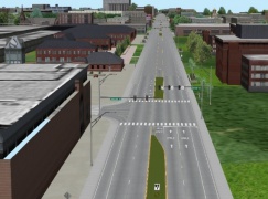
Springfield Road Network Screenshots:


